
Road day
Follow County Road 12 inland
The paved Gunflint Trail, also called Cook County Road 12, runs roughly 57 miles from Grand Marais toward Saganaga Lake. Allow a full day for the far end and a hike or museum visit, plus the return drive.
Gunflint Trail guide
Drive the Gunflint Trail from Grand Marais to boreal lakes, outfitters, lodges, Honeymoon Bluff, and Chik-Wauk, with current forest alerts.
How to drive it
Road day
The paved Gunflint Trail, also called Cook County Road 12, runs roughly 57 miles from Grand Marais toward Saganaga Lake. Allow a full day for the far end and a hike or museum visit, plus the return drive.
Mid-Trail
The Poplar Lake area provides a useful middle destination for an outfitter stop, lodge meal, or access to nearby trails without driving to the far end of the road.
Trail's end
Near Saganaga Lake, Chik-Wauk Museum and Nature Center tells the story of the region’s people and natural history in a former lodge. Its buildings operate seasonally; check the calendar before making it your destination.
Road north
The Gunflint Trail leaves Highway 61 in Grand Marais and climbs inland through Superior National Forest. Lakes, canoe outfitters, lodges, and trailheads sit along the road and its side roads. Poplar Lake is a natural Mid-Trail destination; Chik-Wauk and Saganaga Lake are near the far end.
Choose a destination

Easy
Choose an outfitter, public access, or lodge destination before leaving town; private resort property is not a general lake-access promise.

Easy to moderate
Honeymoon Bluff is a roughly half-mile loop with a steep climb and lake views. Turn onto Clearwater Road (County Road 66) to reach the trailhead; stairs and boardwalk can be slippery when wet or icy. Check forest alerts before leaving town.

Variable
Chik-Wauk is seasonal. Boundary Waters entry is a separate permit-and-conditions decision, not an automatic extension of the scenic drive.
Pitfalls
Fuel and service
Services are spaced far apart beyond Grand Marais, and cell coverage can be unreliable. Fill up in town, download a map, and bring water, snacks, and layers. Check lodge and outfitter hours before relying on a stop.
Weather
The harbor can look different from the forest road. Check the forecast, but be ready to swap in a shorter trail or a warmer town afternoon.
Boundary Waters
Driving the Gunflint Trail does not itself require a wilderness permit. If you plan to enter the Boundary Waters Canoe Area Wilderness (BWCAW), check the permit rules for your trip, entry point, and season, along with closures and fire restrictions.
Overstacking
Pick a main destination before adding side roads. Poplar Lake and a short hike can make a satisfying outing; Chik-Wauk adds a longer drive, especially if you stop along the way.
Official resources
Find forest alerts, recreation information, and seasonal visitor details from their sources.
Continue
Weekend
Compare the Gunflint with Cascade River or Devil's Kettle before assigning the weekend's longest daylight block.
Compare the weekend →Stay
Stay near the harbor for restaurants and Lake Superior, or choose a Gunflint-area lodge or cabin for more time among the inland lakes.
Choose lodging →FAQ
Yes, for a Mid-Trail destination such as Poplar Lake or a short hike. Reaching Chik-Wauk at the far end and returning to Grand Marais is better treated as a full day.
The Gunflint is an inland drive through forest and lake country, with opportunities for hiking, paddling, and visiting historic Chik-Wauk. A North Shore waterfall stop is generally a shorter outing from town.
For a scenic drive, no. But layers, water, snacks, fuel, and shoes that can handle wet rock or muddy pullouts are wise.
Pack the outdoor day
Second Star gear guide
National Park Day Pack Guide
Trailhead packing list
Water, weather layers, trail comfort, binoculars, and the practical pieces that make overlooks and short hikes easier.
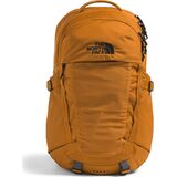
Daypacks & Packs
$86.93
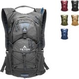
Hydration Packs
$59.99
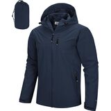
Packable Rain Jackets
$65.99